The parish door
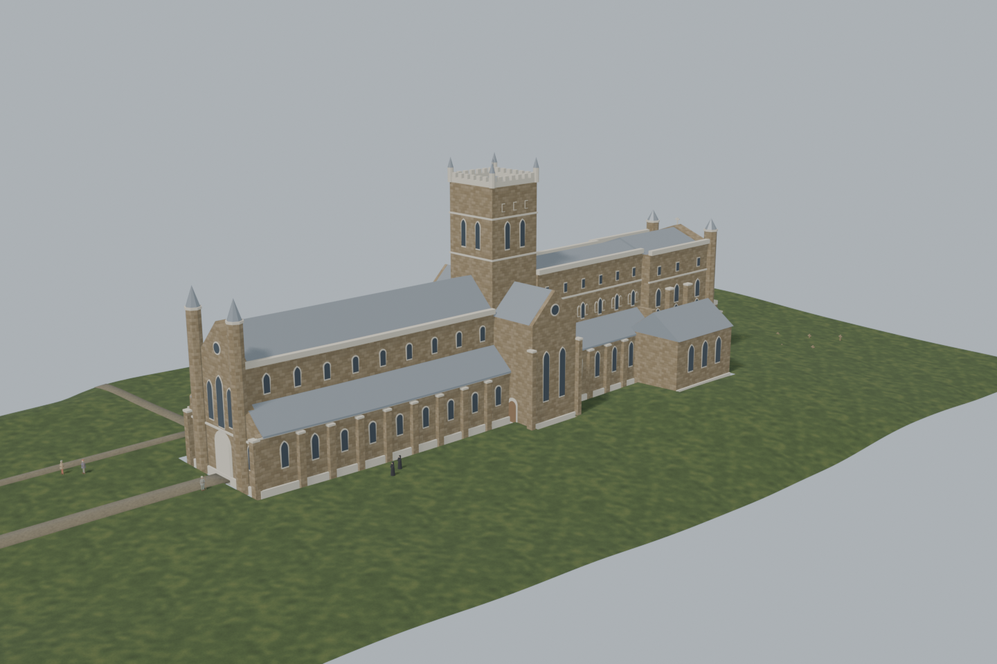
The nave served the people of Tynemouth as their parish church. Pilgrims come up from the haven to the north porch; townsfolk use the great west door.
 Cairn
British History Quest

Every November Britain remembers those who died in war. Poppies grew on the churned-up battlefields of Flanders, and at eleven o'clock on 11 November 1918 the guns of the First World War fell silent.
The day the guns fell silent →Around 1500 · the Benedictine priory church
The priory church of St Mary and St Oswin on Tynemouth headland as it stood before 1539: the parish nave, the crossing tower, the tall lancet east end of St Oswin's presbytery with its upper chamber, the Lady chapel and the Percy Chantry. It can be seen from inside the grounds and from the Spanish Battery and Sea Banks car parks.
View from anywhere. No camera or location permission needed.
4.2 MB · downloaded on demandDrag to orbit; scroll or pinch to zoom; right-drag or two-finger drag to pan. With the viewer focused: arrow keys rotate, +/− zoom, 0 resets.
Inside the green area the camera view shows the scene from where you really stand, at your real height — on a bridge you look down on it. Outside the area the app shows it from the marked demo point instead. Select a point on the map to check it, then load the 3D scene to preview the view from there.
The placement is a desktop reconstruction lined up with today’s map; it is not a surveyed position. Access, closures and sightlines on the ground are not checked.
Select a point on the map. Your location is requested only when you press “Check my location”.
Walk round the priory church as it stood a generation before the Dissolution, from the parish door to the shrine end.
The people are fictional illustrations, not records of particular monks or visitors.
Load the 3D scene to visit these viewpoints.The nave served the people of Tynemouth as their parish church. Pilgrims come up from the haven to the north porch; townsfolk use the great west door.
A low central tower stood over the crossing, between the nave and the monks' choir. Its height and form are not recorded.
The tall lancets of about 1190 lit the presbytery where St Oswin's shrine stood. An upper chamber was later built over its vault, and the little Percy Chantry was added to the east wall in the 1400s. This end still stands.
From the Spanish Battery the church rose above the headland's walls, a landmark for every ship entering the Tyne.
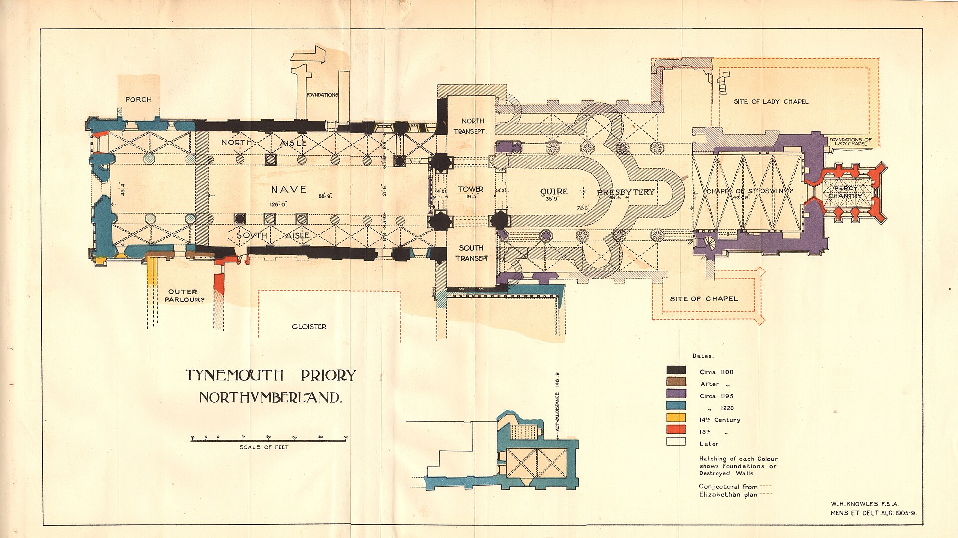
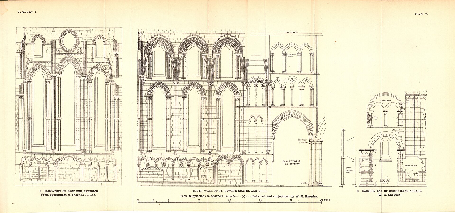
An evidence-informed study of the church around 1500. The plan follows W. H. Knowles's 1910 measured survey and the standing east end; the presbytery's lancets, its upper chamber and the Percy Chantry follow the surviving fabric. Wall heights away from the east end, roof pitches, the crossing tower, the Lady chapel and the south chapel are interpretive, the last two drawn from the conjectural Elizabethan plan. The monastic buildings, the castle walls and the gatehouse are not modelled. Not a surveyed archaeological model or an approved on-site AR installation. Horizontal placement uses a desktop control-point fit.
Nave of nine bays with aisles, crossing, short transepts, aisled choir, aisleless presbytery and Percy Chantry, placed on today's ruin outline (0.34 m RMS).
Tall lancets in the first stage, smaller lancets and a vesica above, the upper chamber of the 14th–15th century under a low leaded roof; vault and interior not modelled.
Only low walls and the west front survive. Heights, window rhythm, roofs and the tower are drawn from comparable northern churches and are not recorded.
Knowles marks both as conjectural from the Elizabethan plan; footprints follow his dotted outlines, elevations are invented.
Benedictines in black habits, pilgrims to St Oswin and men of the castle garrison; individuals and actions are invented.