Through the double gateway
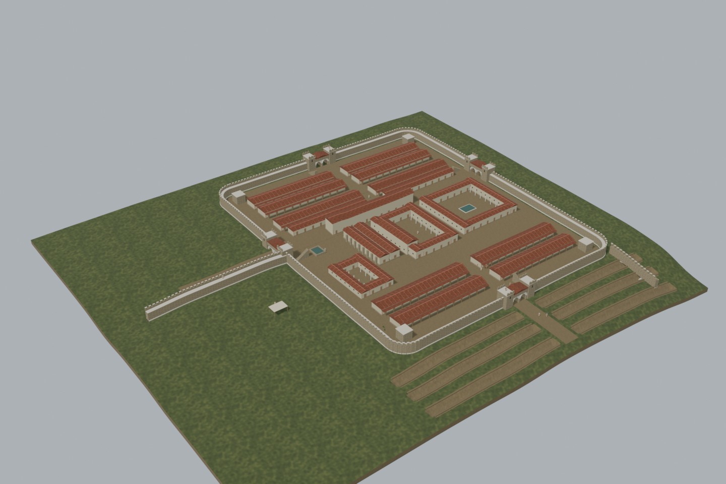
Two auxiliaries return while a clerk waits inside the southern entrance. The gateway leads into the fort’s street network.
 Cairn
British History Quest

Every November Britain remembers those who died in war. Poppies grew on the churned-up battlefields of Flanders, and at eleven o'clock on 11 November 1918 the guns of the First World War fell silent.
The day the guns fell silent →Around AD 200 · Wallsend’s Roman fort
Explore the reconstructed Roman fort at Wallsend: four gateways, barracks, courtyards and a 65-metre reach of Hadrian’s Wall, with a short southern branch.
View from anywhere. No camera or location permission needed.
16.5 MB · downloaded on demandDrag to orbit; scroll or pinch to zoom; right-drag or two-finger drag to pan. With the viewer focused: arrow keys rotate, +/− zoom, 0 resets.
Inside the green area the camera view shows the scene from where you really stand, at your real height — on a bridge you look down on it. Outside the area the app shows it from the marked demo point instead. Select a point on the map to check it, then load the 3D scene to preview the view from there.
The placement is a desktop reconstruction lined up with today’s map; it is not a surveyed position. Access, closures and sightlines on the ground are not checked.
Select a point on the map. Your location is requested only when you press “Check my location”.
Follow an imagined return to Segedunum, from the southern gateway to the working buildings and the Wall.
These short scenes are fictional illustrations of military life, not records of particular people or events.
Load the 3D scene to visit these viewpoints.Two auxiliaries return while a clerk waits inside the southern entrance. The gateway leads into the fort’s street network.
A porter brings grain towards the stores. Nearby, the headquarters courtyard provides a place for orders, administration and ceremony.
A groom tends a horse beside the cavalry accommodation. The excavated barracks support a close relationship between the men and their mounts.
A sentry watches from the western Wall. This model shows only a short reach: the frontier continued west beyond the diorama.
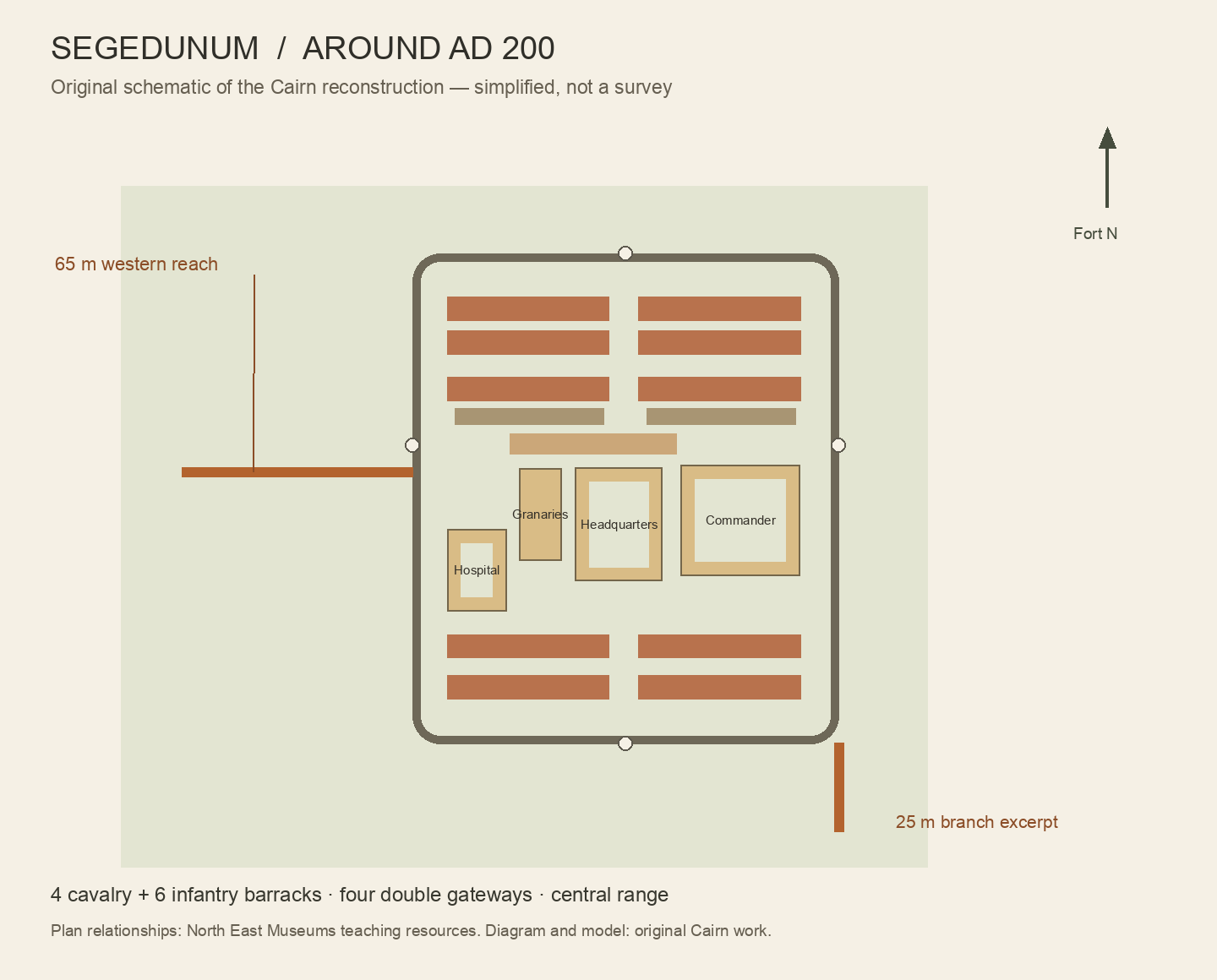
An evidence-informed first study of the fort around AD 200. The enclosure, gates and broad building arrangement follow published sources; heights, roof forms, smaller details and all activity are interpretive. The southern wall branch stops at the scene edge before the river. This is neither a surveyed archaeological model nor an approved on-site AR installation. Horizontal placement uses a desktop control-point fit.
A nominal 120 × 138 m rounded enclosure with four double entrances. Masonry heights, arches, tower tops and rampart access are conjectural.
Four cavalry and six infantry blocks accompany a headquarters, commander’s house, double granary, hospital and workshops. Building footprints are simplified from the teaching plan; roof construction and colours are interpretive.
A 65 m western reach joins south of the west gate; a 25 m southern branch leaves the southeast corner. End cuts are model boundaries, not historical endpoints. No southern Vallum is added.
Eighteen adult figures, two horses, grain supplies, cooking and a small trader’s station suggest daily routines. Their identities, positions, actions and costume details are invented.