A boat beside Waverley Bridge
From the modern pedestrian footway, look down to a wooden rowing boat on the water below. The bridge itself belongs to today’s viewpoint, rather than the 1750 landscape.
 Cairn
British History Quest

Every November Britain remembers those who died in war. Poppies grew on the churned-up battlefields of Flanders, and at eleven o'clock on 11 November 1918 the guns of the First World War fell silent.
The day the guns fell silent →Around 1750 · before drainage began
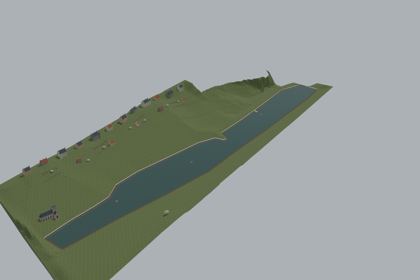
Explore Edinburgh’s lost loch around 1750: muddy banks, the Old Town shore and three wooden rowing boats. The compact landscape runs between today’s Princes Street and the Royal Mile, with only a small LiDAR-informed north-flank fragment below the castle.
View from anywhere. No camera or location permission needed.
9.5 MB · downloaded on demandDrag to orbit; scroll or pinch to zoom; right-drag or two-finger drag to pan. With the viewer focused: arrow keys rotate, +/− zoom, 0 resets.
Inside the green area the camera view shows the scene from where you really stand, at your real height — on a bridge you look down on it. Outside the area the app shows it from the marked demo point instead. Select a point on the map to check it, then load the 3D scene to preview the view from there.
The placement is a desktop reconstruction lined up with today’s map; it is not a surveyed position. Access, closures and sightlines on the ground are not checked.
Select a point on the map. Your location is requested only when you press “Check my location”.
Look down from Waverley Bridge and the National Gallery terraces, then across the valley from Edinburgh Castle. The modern bridge and Mound are viewing platforms; the historical water lies below.
Boats and people are illustrative. Bridge, terrace and castle heights are planning estimates; castle entry requires a ticket.
Load the 3D scene to visit these viewpoints.From the modern pedestrian footway, look down to a wooden rowing boat on the water below. The bridge itself belongs to today’s viewpoint, rather than the 1750 landscape.
A second boat passes close to the gallery’s modern elevated terraces. The lost loch continues beneath the later Mound; the gallery buildings are not part of the 1750 reconstruction.
From the castle’s ticketed northern outlook, see the western water and the valley stretching east. The public Esplanade’s northern edge has its own viewpoint in the view menu.
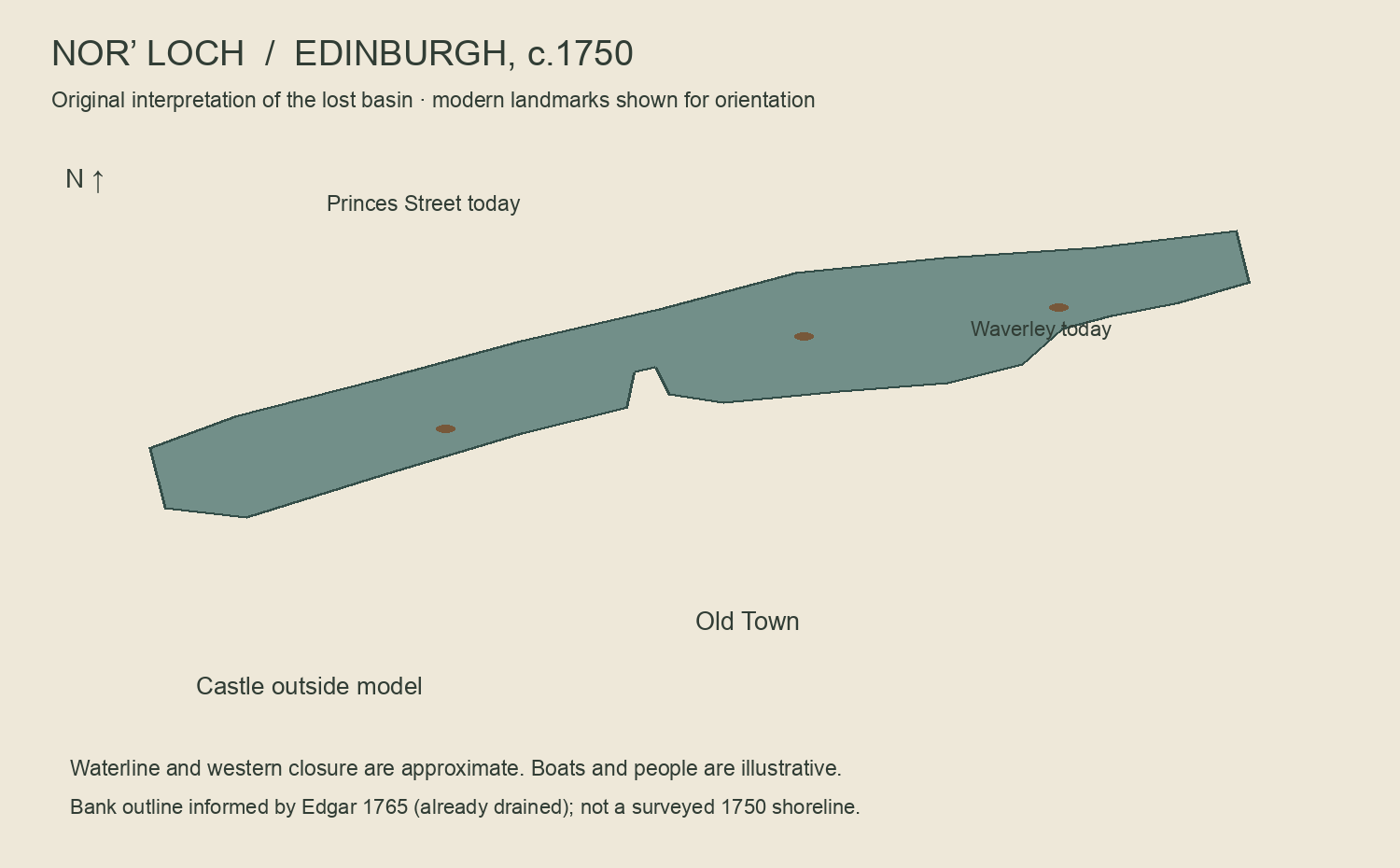
The lake’s existence, broad basin and castle/town relationship are documented. The shoreline is an approximate interpretation transferred from Edgar’s 1765 post-drainage bank outline with two desktop landmark controls. Western closure, water level, terrain, architecture detail, boats, landing and people are authored interpretations. A zero two-point fit residual does not establish accuracy: a conservative 25 m horizontal planning buffer is used. The loch was shallow, polluted and marshy in places; this is not a surveyed water-level reconstruction. Modern observer heights are estimates; on-site vertical calibration and access review are pending. Landscape cropped to modern Princes Street and Royal Mile, avoiding the castle summit. The small north-flank terrain fragment uses modern Scottish Phase 5 LiDAR, with a 90 m native-height cut; this is a modern terrain reference, not proof of 1750 ground or water levels. Horizontal placement uses an approximate historical map interpretation.
A continuous muddy-edged lake is interpreted for c.1750. The 1765 plan records the basin after drainage; no exact 1750 shoreline or depth is asserted. Water is subdued olive grey, with reeds and exposed mud.
37 simplified tenements form the southern shore. The model stops at the Royal Mile and Princes Street; no castle or summit is modelled. A limited north-flank fragment follows a modern LiDAR terrain reference, capped by its 90 m contour. Individual façades and the historical ground/water transition remain interpretive.
Original small wooden craft with planked hulls, benches, oars and fictional adult rowers. Their number, precise type, routes and landing are invented to bring the vanished water to life; no specific boat service or journey is claimed.
In the camera view the loch is seen from wherever the visitor stands inside one viewing area around it, at their real height — Waverley Bridge, the gallery terraces and the castle’s northern outlook (ticketed) look down on the water. Access, closures and sightlines are not checked on the ground.