The road north
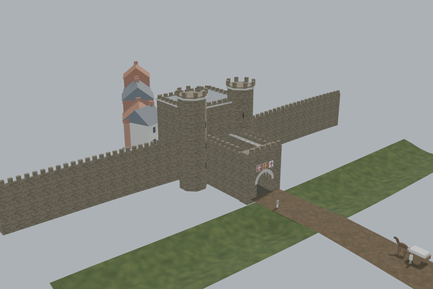
Travellers from the north came over the ditch and through the barbican's outer arch, under the shields of St George, England and Newcastle.
 Cairn
British History Quest

Every November Britain remembers those who died in war. Poppies grew on the churned-up battlefields of Flanders, and at eleven o'clock on 11 November 1918 the guns of the First World War fell silent.
The day the guns fell silent →Around 1740 · the gate as the town gaol
The largest gate of Newcastle's town wall, where Newgate Street meets Gallowgate and Blackett Street today: a three-storey tower with octagonal corner turrets facing north, a barbican in front of it, the town wall running off on either side, and King James I in his niche over the town-side arch. From 1399 until 1822 the gate was the town gaol; it was pulled down in 1823 and Blackett Street was laid out along the line of the wall.
View from anywhere. No camera or location permission needed.
2.4 MB · downloaded on demandDrag to orbit; scroll or pinch to zoom; right-drag or two-finger drag to pan. With the viewer focused: arrow keys rotate, +/− zoom, 0 resets.
Inside the green area the camera view shows the scene from where you really stand, at your real height — on a bridge you look down on it. Outside the area the app shows it from the marked demo point instead. Select a point on the map to check it, then load the 3D scene to preview the view from there.
The placement is a desktop reconstruction lined up with today’s map; it is not a surveyed position. Access, closures and sightlines on the ground are not checked.
Select a point on the map. Your location is requested only when you press “Check my location”.
Stand where Newgate Street meets Gallowgate in the 1740s: the town wall's largest gate, and the town's prison inside it.
The people are fictional illustrations, not records of particular people.
Load the 3D scene to visit these viewpoints.Travellers from the north came over the ditch and through the barbican's outer arch, under the shields of St George, England and Newcastle.
The tower stood three storeys high with an octagonal turret at each outer corner. A portcullis hung in the vaulted passage.
Over the town-side arch King James I stood under his own arch, looking down Newgate Street.
From 1399 the gate was the town's prison. Those who died in it, or on the gallows on the Town Moor, were buried in St Andrew's churchyard next door.
The new gaol in Carliol Square replaced it. The gate was pulled down in 1823, the last of its walls blown down with gunpowder, and Blackett Street was laid along the line of the wall.
An evidence-informed study. The gate's place (the wall's line from the surviving stretch at St Andrew's churchyard, and the HER grid reference), its plan type (a three-storey tower flat on the town side with projecting octagonal corner towers on the outer front, a rib-vaulted passage with a portcullis, a barbican to the north with galleries on its sides) and its use as the gaol follow the Tyne and Wear HER and published accounts. All dimensions and heights, windows, roofs, the houses inside the gate and all daily activity are interpretive. Not a surveyed reconstruction or an approved on-site AR installation. Horizontal placement uses a user-selected demonstration anchor.
The wall's line follows the surviving stretch at St Andrew's churchyard; the gate stands where that line crosses Newgate Street, 4 m from the HER grid reference.
Three storeys, flat on the town side, octagonal corner turrets on the outer front, a vaulted passage with a portcullis.
An outwork to the north with a gallery along each side and the three shields over its outer arch.
The king's statue under an arch above the town-side front.
Barred windows on the upper floors and a door to the gaoler's lodging; the arrangements inside are not modelled.
7 ft thick, 6.4 m to the wall walk, merlons; the ditch outside is shown as a shallow grassed hollow with the road on a causeway.
Houses along Newgate Street inside the gate, a carter, travellers, the gaoler and a woman bringing food to a prisoner are invented.