Beside the water
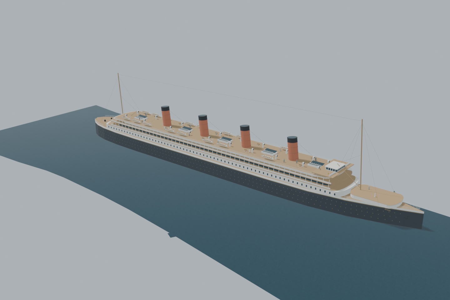
From Quayside, the black hull rises above you, with promenades and four red funnels beyond.
 Cairn
British History Quest

Every November Britain remembers those who died in war. Poppies grew on the churned-up battlefields of Flanders, and at eleven o'clock on 11 November 1918 the guns of the First World War fell silent.
The day the guns fell silent →1907 appearance · an imagined Quayside berth
Meet the elegant four-funnel liner built at Wallsend: black hull, cream promenades, red funnels and a busy boat deck. This full-size interpretation is placed at an imagined berth between Newcastle’s Tyne Bridge and Millennium Bridge. Compare the view beside the water with the view down from Tyne Bridge.
View from anywhere. No camera or location permission needed.
8.7 MB · downloaded on demandDrag to orbit; scroll or pinch to zoom; right-drag or two-finger drag to pan. With the viewer focused: arrow keys rotate, +/− zoom, 0 resets.
Inside the green area the camera view shows the scene from where you really stand, at your real height — on a bridge you look down on it. Outside the area the app shows it from the marked demo point instead. Select a point on the map to check it, then load the 3D scene to preview the view from there.
The placement is a desktop reconstruction lined up with today’s map; it is not a surveyed position. Access, closures and sightlines on the ground are not checked.
Select a point on the map. Your location is requested only when you press “Check my location”.
An imagined Edwardian arrival: discover Mauretania’s long silhouette, open promenades and crowded boat deck from today’s riverside.
The berth, people and actions are illustrative; the ship’s early appearance is evidence-informed.
Load the 3D scene to visit these viewpoints.From Quayside, the black hull rises above you, with promenades and four red funnels beyond.
From Tyne Bridge’s eastern footway, look down towards the decks. The nominal bridge surface is 26 m above high water.
Lifeboats, benches, ventilators and fictional travellers bring the Edwardian liner to life.
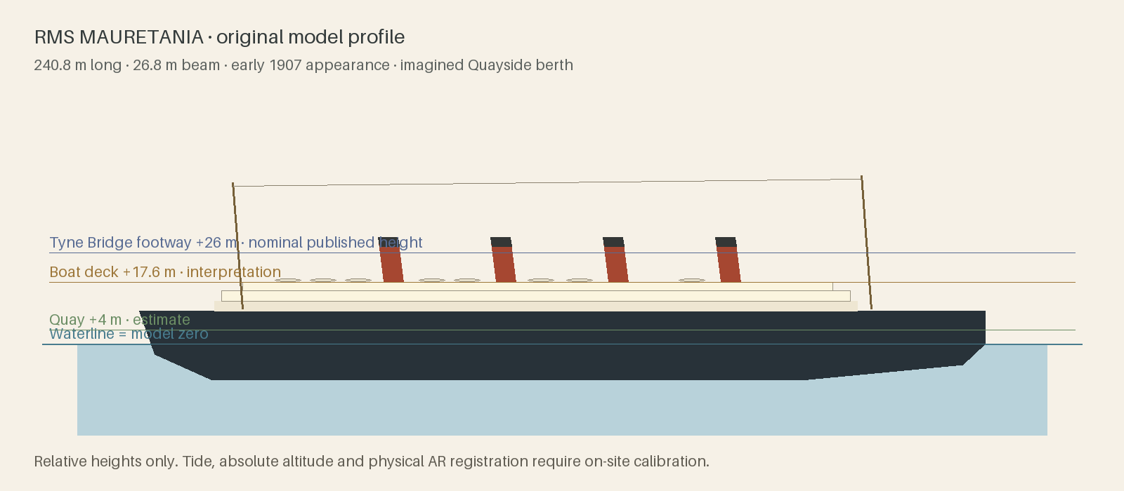
Mauretania was built at Wallsend and launched in 1906. Her 1907 exterior is interpreted from period elevation and photographs at 240.8 × 26.8 m. This Quayside berth is imagined, not evidence that she docked here. Fine hull lines, elevations, colours, equipment and people are simplified original interpretations. Water is a nominal high-water plane, quay height is an estimate, and bridge height is a nominal published value. Tide, survey datum, current access and native AR alignment are not calibrated. Horizontal placement uses an imagined water berth.
The full metric length and beam follow published particulars. Curved hull, open promenades, four raked funnels, two masts and sixteen boats interpret the early arrangement; fine geometry is not a shipbuilder’s surveyed hull model.
The authored water berth is east of Tyne Bridge, clear of both modern bridges and the mapped shoreline. No visit, docking manoeuvre, navigable depth or historic berth at this coordinate is asserted. Modern context is shown for orientation.
The waterline is model zero, about mean high water springs (+2.4 m ODN). Quay surface +1.4 m is today’s ground from the EA LiDAR DTM; Tyne Bridge footway +26 m is a nominal height above high water. Eye height adds 1.7 m. In the camera view a visitor stands at their phone’s own height, so from the bridge they look down on the deck; the tide is not modelled and GPS height is only good to a few metres.
Twenty fictional adult figures, luggage, deck chairs and mooring ropes suggest an Edwardian liner at rest. No named passengers or specific historical event are recreated.