The Wall on the crags
Here the Wall rides the top of the Whin Sill. To the north the crags fall away to Crag Lough; no ditch was dug, the cliff was the obstacle.
 Cairn
British History Quest

Every November Britain remembers those who died in war. Poppies grew on the churned-up battlefields of Flanders, and at eleven o'clock on 11 November 1918 the guns of the First World War fell silent.
The day the guns fell silent →Around AD 130 · the Wall on the Whin Sill crags
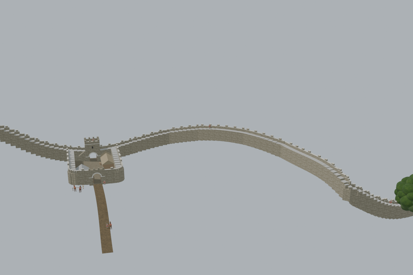
Hadrian's Wall as it stood a few years after it was built: 260 metres of the curtain climbing over the crags from Sycamore Gap, across Castle Nick and up Peel Crags, with Milecastle 39, its gates and north tower, soldiers of the garrison on the wall walk and three cavalry horses at the south gate. A sycamore stands in the gap in memory of the famous tree felled by vandals in 2023; it is a symbol, not a claim that a tree grew there in Roman times.
View from anywhere. No camera or location permission needed.
4.7 MB · downloaded on demandDrag to orbit; scroll or pinch to zoom; right-drag or two-finger drag to pan. With the viewer focused: arrow keys rotate, +/− zoom, 0 resets.
Inside the green area the camera view shows the scene from where you really stand, at your real height — on a bridge you look down on it. Outside the area the app shows it from the marked demo point instead. Select a point on the map to check it, then load the 3D scene to preview the view from there.
The placement is a desktop reconstruction lined up with today’s map; it is not a surveyed position. Access, closures and sightlines on the ground are not checked.
Select a point on the map. Your location is requested only when you press “Check my location”.
Walk the Wall a few years after Hadrian's legions built it, from Sycamore Gap to the milecastle at Castle Nick.
The soldiers and horses are fictional illustrations, not records of particular men.
Load the 3D scene to visit these viewpoints.Here the Wall rides the top of the Whin Sill. To the north the crags fall away to Crag Lough; no ditch was dug, the cliff was the obstacle.
The Wall drops into the gap and climbs out again. The sycamore here is a memorial, not a Roman tree: it stands for the famous one that grew against the Wall until vandals felled it in 2023.
A small fort every Roman mile. Castle Nick held a handful of men, gates north and south, an oven in one corner and a building in the other.
Sentries walk the parapet and stand over the gap; a horse is led up to the south gate, where two more are tied.
An evidence-informed study. The line of the Wall and the milecastle's outline follow today's consolidated remains as mapped in OpenStreetMap, and both stand on today's LiDAR ground. The milecastle's size (19 by 15.5 m inside, long axis), its Type II gateways, the south-east oven and the south-west building follow the published record. The Wall's height (4 m to the wall walk), the crenellated parapet, the tower over the north gate, roofs and all daily activity are interpretive. Not a surveyed archaeological model or an approved on-site AR installation. The sycamore in the gap is symbolic: it stands in memory of the tree felled in 2023, not as evidence of a tree in Roman times. Horizontal placement uses a user-selected demonstration anchor.
The curtain follows today's consolidated Wall over Highshield Crags, Sycamore Gap, Castle Nick and Peel Crags, on today's LiDAR ground.
2.3 m Narrow Wall; 4 m to the wall walk, stepped where the crags are steep; a 1 m breastwork with merlons on the north face. No ditch: the crags are the obstacle here.
Placed on today's outline; 19 m by 15.5 m inside on the long axis, walls 2.8 m, rounded southern corners, Type II gateways north and south.
A tower over the north gate as in most reconstructions; its height and the roofs are not recorded. The timber hut along the east side stands for the garrison's quarters.
A stone oven in the south-east corner and a rectangular building with a sunken floor in the south-west corner.
Auxiliaries of the garrison on watch, a dispatch rider's horse being led up and two horses tied at the south gate; individuals and actions are invented.
Placed on the stump of the Sycamore Gap tree, which grew against the Wall until vandals felled it on the night of 27–28 September 2023. It stands here in its memory; nothing is known of a tree in the gap in Roman times.